Wednesday 26 December 2012

The Cut through Winkfield


Boxing Day started wet and just got wetter!  We no sooner left the road than paths quickly became ankle deep (and deeper) in water.  I wish I'd thought to take some pictures.  It made for some quite funny scenes, especially as DS1 wasn't wearing the right footwear.  I love my North Face boots.  Having spent a year walking through puddles, streams and very wet ground - this was the only day when my feet actually got wet and that wasn't the fault of the boots.  I misjudged a puddle and water came in over the top.  Next on the shopping list - gaiters!


A rather full stream


On the walk across towards St Mary's church.  The rain just kept on coming.

Over the stile - check out those wet trousers!  We were all soaked.  Somehow we didn't think to take waterproofs!


The churchyard of St Mary's Winkfield.  

This walk was only 3.5 miles and with the constant rain there wasn't much time for playing.  We realised how much fitter we've become over the last year. 3.5 miles was easy and we could easily have done the whole lot again.  I think it's time to crank things up a notch. Let's do something longer next time - and hope for better weather.

One of the drier paths

Sunday 11 November 2012

Pudding Hill and Caesar's Camp


Another variation on our Sunday walk in Swinley Forest - this time the boys took their bikes.  We were rewarded with clear skies and sunshine - the boys were even warm in just their tshirts.  Quite a contrast from the previous week in Cumbria.

Pudding Hill in the distance

The walk to the wood from our home is initially quite dull, but quickly becomes wooded.  We walked along Nine Mile Ride for a while to find a safe place to cross and finally made it across into Swinley Forest.  I had a rough plan to walk towards Pudding Hill.  DH wasn't familiar with the area and was pleasantly surprised with the view from the top.


Bracknell is just a small grey splodge from the top of Pudding Hill - it makes you realise how much of the area is wooded and green.  It was a lovely clear day too.

Woods at the top of Pudding Hill

Climbing the hill with bikes was a bit of a struggle and they weren't even rewarded with a downhill ride as, in places, it's just too steep.  A great route for experienced mountain bikers though.  There was a bike race taking place in the area so some places were cordoned off.  We turned back and took another turn and decided to just visit Caesar's Camp, rather than make our way to the Look Out.  It was all a bit tricky with the boys on bikes (youngest on an old heavy bike) and DS2 was soaked from riding through a big puddle!  We decided that next week we'll do a bit more planning and all walk.  I can't imagine the weather being as good though.


Friday 2 November 2012

Buttermere Circuit


Our last full day in the area and we thought we really ought to walk around the lake.  After almost a full week of rain, the morning looked promising.  Icy wind but fine.


We headed down to the lake, but somehow managed to corner some sheep.  We pulled ourselves over to one side though and they came rushing past - looking a little frightened!

DS3 climbed up and unlocked the gate - then pushed it open (with him on it) to let us all through.  Quite an ingenious way for a little person to do the job, although maybe not quite complying with the countryside code.  We did close it again afterwards, with DS on the right side.

View back towards the cottage - on the left.

DS3 full of enthusiasm

The outward leg was a lot of fun.  We observed the spray whipped up on the lake by the powerful wind.  Keeping the boys out of the lake was a job in itself.  Wellies were a mistake! The terrain was not quite Virginia Water!  I was the only one in hiking boots and was very glad of them.  

Loving the wind


As we reached the top end of the lake and Gatesgarth Farm, the weather started to turn.  The farmer was herding his sheep back into the field.  With some sun and my proper camera, I think these sheep would have made a good picture.

The wind, rain and hail battered us along the return leg. With freezing faces and hungry bellies, we found a spot under some trees with a couple of rocks for the boys to sit on, grabbed our lunch and quickly moved on.  Continuing with heads down, pushing on into the hail, we came to another wooded area and the boys were both getting very cold.  They put on their extra layers which they'd been carrying in their bags.  Eventually I gave my gillet to DS3 who was almost ready to give up by this stage.  The gillet soaked straight though, and wearing my hat too, passers by mistook him for a girl.  Luckily, he didn't hear!

Almost done - and soaked through!

We reached the home end of the lake and somehow the boys summoned up one last burst of energy for a paddle in the field (which was a lake itself by now) and some stone skimming.  Then finally back to the cottage for a change of clothes and a hot drink!

I don't think we've ever suffered so much with the cold and wet.  Our waterproofs were well and truly tested.  We were thankful to finally be cosy and warm, but so glad we'd made the most of our last day.  Lessons I've learnt - Wellies are not for long walks - take plenty of extra layers and gloves.  You can't predict what the sky will throw at you - especially in Cumbria!

Sunday 9 September 2012

High Curley - Bagshot Heath

Surrey Hill - the inspiration for this walk

Having cycled to the "other" Bagshot Heath on the North side of the M3, I wanted to take the kids as it was really beautiful. I couldn't find a good spot to park though. I saw High Curley shown as a view point on the OS map and we decided to go along and have a look! We didn't follow a walk - or even a map in the first place. Just following the route Westerley from leisure centre car park we were rewarded with lovely views very from the start.

The route through the woods to High Curly is quite picturesque.  We were pleased we'd remembered the binoculars as there are places of interest to spot through the trees.  It's a shame I took no pictures at the top, but there wouldn't' be a lot to see (except, of course, the view) because things such as Wembley were only just visible to the naked eye.  It was quite fun to discover landmarks and familiar places.  Bagshot Park is nicely visible, I'd never seen that before.


There is a lot of MOD land and warnings signs. The boys couldn't resist playing armies.


Lots of beautiful woodland.  We really should have followed a walk or at least plotted a route beforehand because at one point we discovered the only reliable way back to the car was through some residential streets.  This was a rather grey part of the walk and not what we'd anticipated.  The boys were rewarded with a play in the park at the end though and I walked up the road to pick up the car.
We would return, but plan a better route next time.

Wendy Booth - Portrait Artist

Saturday 30 June 2012

Silchester Roman Walls and Amphitheatre


Once you find the Wall Lane car park, it's easy enough to find your way around the walls as long as you take the Southern exit out of the car park along the footpath.  Take a map though so you don't miss the amphitheatre.  To be honest, we actually missed the path back to the car park and got as far as the North Gate before we realised our mistake!

The 2.5 miles only took us an hour and a half.  It was just my 9 year old and me so it was easy to build up a bit of pace without distraction.

Once the footpath meets the wall you can continue into the middle of the old town and see the dig site.  Students from Reading University spend 8 weeks excavating the area in the summer and even have open days with activities for children.  Today they were in residence but didn't seem to be actively digging.


Archeaology students camping near the dig site


We couldn't work out what these holes were in the walls of the amphitheatre.  It would be interesting to find out.


View from one of the high paths around the amphitheatre

One of the steep paths leading down from the upper level.  Probably no historic relvance, but fun to climb (I'm told!).

We decided to follow the wall by heading back down Wall Lane the short distance to the wall footpath (the way we came).   

We continued around - through a gate and past the farm


However, this is the route back to the dig site, so we followed another path (past St Mary's church on our left) to meet the road. This turned out to be a private route through the farm (oops!).  We have visited the 17th century church before and it's well worth a detour if you have the time. 

View along the Roman Wall


Back towards the church with the wall on the left

We walked along the path at the top of the wall.  You can take a lower route along the outside if you prefer.


On the wall - how much fun for a 9 year old?!

View from top of the South Western wall

As you turn onto the Western wall (and we dropped down to the lower level) we spotted a stream.  It would have been a lovely place to play if we'd had longer.  We must come back again soon!

From the sheltered lower path we spotted several trees growing out of the wall.

Somehow we missed the path back to the car park and walked on as far as the North Gate.  By this stage we were running late and the last half mile or so involved lots of running and wrong turns!  It's hard to see how we managed this when you look at the proper route at the top of the page.  How could it be simpler?!  It was fun though and we laughed so much!

One very tired boy on the footpath back to the car park.
Wendy Booth - Portrait Artist

Sunday 24 June 2012

Wayland's Smithy and Uffington Horse

The Uffington White Horse is Britain's oldest chalk hillside figure.  It is a short walk up hill from the car park, but we combined it with a walk to Wayland's Smithy for this 3.3 mile walk.  The walk itself includes part of the Ridgeway National Trail and can be found on the Walking Britain Website.


The first leg of the walk took us along Ridgeway.  The sun decided to join us today and made for the kind of weather you'd hope for at this time of year.


The wind rippled through long grass (wheat, barley?) in all the surrounding fields which created the illusion of long soft fur.  Even the hills were rippling like green sea.

Making a start along Ridgeway


I'd made the mistake of promising my six year old that there might be an ice cream for him if we get back to the car park while the ice cream van was still there.  So, for him, it became a very long journey of constantly asking the time and if he could go back to the car park now please! 


The path to Wayland Smithy was a short straight stroll along the chalk path. 


After several junctions and changes in weather we reached our first goal...


Wayland Smithy - iron age long barrow


The boys had a great time investigating the burial chambers


DS2 even found this replica leather pouch


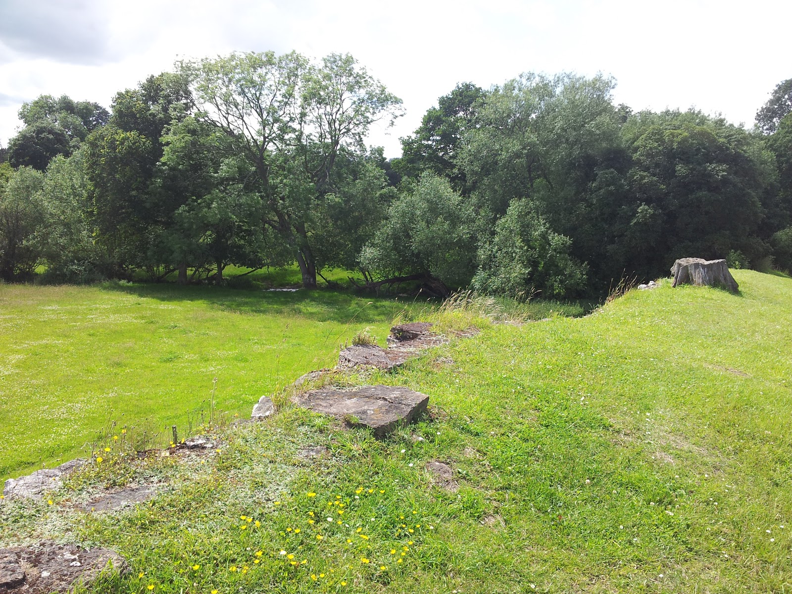
Stones along the length of the barrow


Three of us at the entrance to Wayland Smithy


Following the return journey along the Ridgeway we climbed the hill path, which was, of course, very chalky.  Luckily it we weren't visiting in heavy rain, or I think the fun with splashing in chalk puddles would have been too hard to resist.


We were all quite excited when DS3 Spotted a lizard on a style (we're easily pleased!), but it was too quick for me and I'm afraid I didn't get a picture.


The earthworks of the old hill fort - Uffington Castle.


Walking down from the castle it isn't immediately obvious where the horse is, but it was signposted and in the end was hard to miss.


The horse is quite an abstract figure and upclose it's very hard to make out.  In the background you can just make out Dragon Hill - small flat-topped hill.


From the top of the steep hill, looking back towards the chalk horse.


The clouds finally started to break on our way back down the hill.


Even close to the "viewing point" it is hard to make out the horse on the top (left) of the hill.  Apparently, the best place to see it is from the air!

The ice cream van was still in the car park so the boys enjoyed an ice cream before our long drive home.